Fátima Walking Routes
Fátima Walking Routes are a network of religious and cultural itineraries that start at several locations and end at the Sanctuary of Fatima.
Developed by the Centro Nacional de Cultura since 1996, in partnership with many institutions and the Shrine of Fatima, they offer safe and pleasant conditions for pilgrims and walkers heading to the Shrine of Fatima, avoiding busy roads in favour of dirt tracks and small rural roads.
These itineraries cover a variety of territories with great cultural and scenic interest and are linked to other national and international itineraries.


Useful information for pilgrims
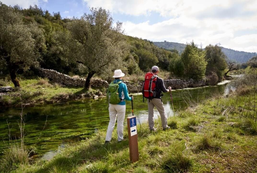
Fátima Walking Routes offer a spiritual journey through Portugal, combining cultural and religious significance. Pilgrims can walk these routes year-round, though the best conditions are in spring, summer, and autumn. While summer may have high temperatures, pilgrims can adjust their schedules to start early in the morning. The routes are designed to accommodate different journey lengths, allowing flexibility according to personal preferences.
Each route begins and ends at public places of religious or cultural significance, such as churches or chapels. Pilgrims will find essential services along the way, including places for food, water, and accommodation. It is important to plan ahead and prepare for the specific conditions of each journey.
The routes are marked with a logo and symbols, though simpler blue arrows may be used in some areas until full signposting is completed. Pilgrims are encouraged to consult the route map for guidance.
Pilgrim’s credentials
The pilgrim’s credential serves as a passport, certifying each stage of the journey and can be stamped at designated locations like tourist offices, parishes, and hotels. The official credential is issued by the National Culture Centre (CNC), which can be obtained from their office in Lisbon, or requested via e-mail or phone. A voluntary €2 donation is suggested to support the credential production.
Preparing for the journey
Pilgrims should plan their stages based on their physical condition and available accommodation. Each stage is typically 25-30 kilometres, and preparation for varying climate conditions is key. Proper hydration, comfortable clothing, and a well-fitted rucksack are essential. Pilgrims are also advised to respect the environmental guidelines for conservation and sustainability during their walk.


The Northern Route
From Valença to Fátima
- 364 km
- 17 days
This route covers Northern and Central Portugal. The scenery is beautiful and diversified, and while the rural and urban landscape gradually changes along the way it is defined by the constant presence of the rivers and mountains that delineate this ancestral land, dotted with small villages, towns and cities.
The landscape between the Rivers Minho and Douro is verdant and a sea breeze blows across it. Between the Rivers Douro and Mondego the coastal plain strikes a contrast with the mountainous inland terrain.
To the south of the River Mondego the landscape undergoes a progressive transformation, eventually reaching the limestone mountains of Aire and Candeeiros. The walker will come to know a substantial part of the geography, history and culture of Portugal.
A considerable stretch of the Northern Route coincides with the Portuguese Way of St. James.
Read more.


Tagus Route
From Lisbon to Fátima
- 150 km
- 6 days
Tagus river sets the tone of this walking route, as well as the complex natural, social and cultural system associated with this great waterway that crosses Portugal. A part of the Way has the river for horizon and advances through the serene landscape of the Lezíria plains.
Another part continues along the plateaus, mountains and valleys of the limestone massif of the Serras de Aire and Candeeiros, the ancestral and characteristic territory of transition between the river system of the Tagus and the Atlantic coast.
This Way is a true cultural and spiritual itinerary of knowledge, encounter, experiences and sharing. The pleasure of new discoveries is always on the horizon, including landscape, heritage and community.
Read more.


Nazaré Route
- 54 km
- 3 days
This walking route takes place amid amazing scenery of great beauty through the Serras de Aire e Candeeiros Natural Park, in the middle of the Estremadura Limestone Massif, the most important karst region in the country. The fauna is varied, with bats, rooks and different species of eagle. The flora is rich in wild and endemic species.
It is also a territory with an abundant network of underground watercourses and great speleological wealth (caves). The path runs through the municipality of Porto de Mós, through the parishes of Pedreiras, Porto de Mós, Alvados and Alcaria. In terms of built heritage, highlights include the Castle and the Churches of São João and São Pedro in Porto de Mós and the Church of Our Lady of Consolation in Alvados.
The route ends in the village of Alvados, a harmonious settlement in a valley. The well-preserved houses are distributed along old paths framed by stone walls, which run through the fields and the mountains, fully integrated with the topography and the natural setting. In small restaurants, genuine delicacies of the local gastronomy can be found, such as cheese, charcuterie and sweets.
Read more.


Médio Tejo Route
Tomar Route
- 1 day
- 31 km
Sertã Route
- 98 km
- 5 days
Abrantes Route
- 91 km
- 4 days
The Médio Tejo Route is located in a territory shaped by the Tagus River water system and the mountain ranges, slopes, and valleys of its northern bank, where rivers and streams flow that irrigate the land and feed this great river.
The landscape is diverse, with serene plains and mountainous areas. Signs of the antiquity of these lands can be found in local toponymy and cultural heritage. Local administrative organisation and systematic settlement date back to the period of the Christian reconquest and the formation of the Kingdom of Portugal (12th-13th centuries), following donations made by the kings to the Military Orders to guarantee the defence of the banks of the Tagus, to attract residents, and to promote social and economic development. Particularly important were the Order of the Knights Hospitaller (Order of Malta) and the Order of the Knights Templar (later Order of Christ), which built castles and churches and contributed to the formation of settlements.
In this territory, so rich in biodiversity and so valuable in cultural terms, the Fátima Walking Routes are organised into three routes that correspond to three cultural itineraries in different geographical areas. Each of the routes leads to the discovery and enjoyment of a multifaceted cultural and environmental heritage, offering pilgrims and hikers unique experiences in harmony with nature and life and in contact with welcoming local people.
Read more.


Candeeiros Route
From Rio Maior to Fátima
- 63 km
- 3 days
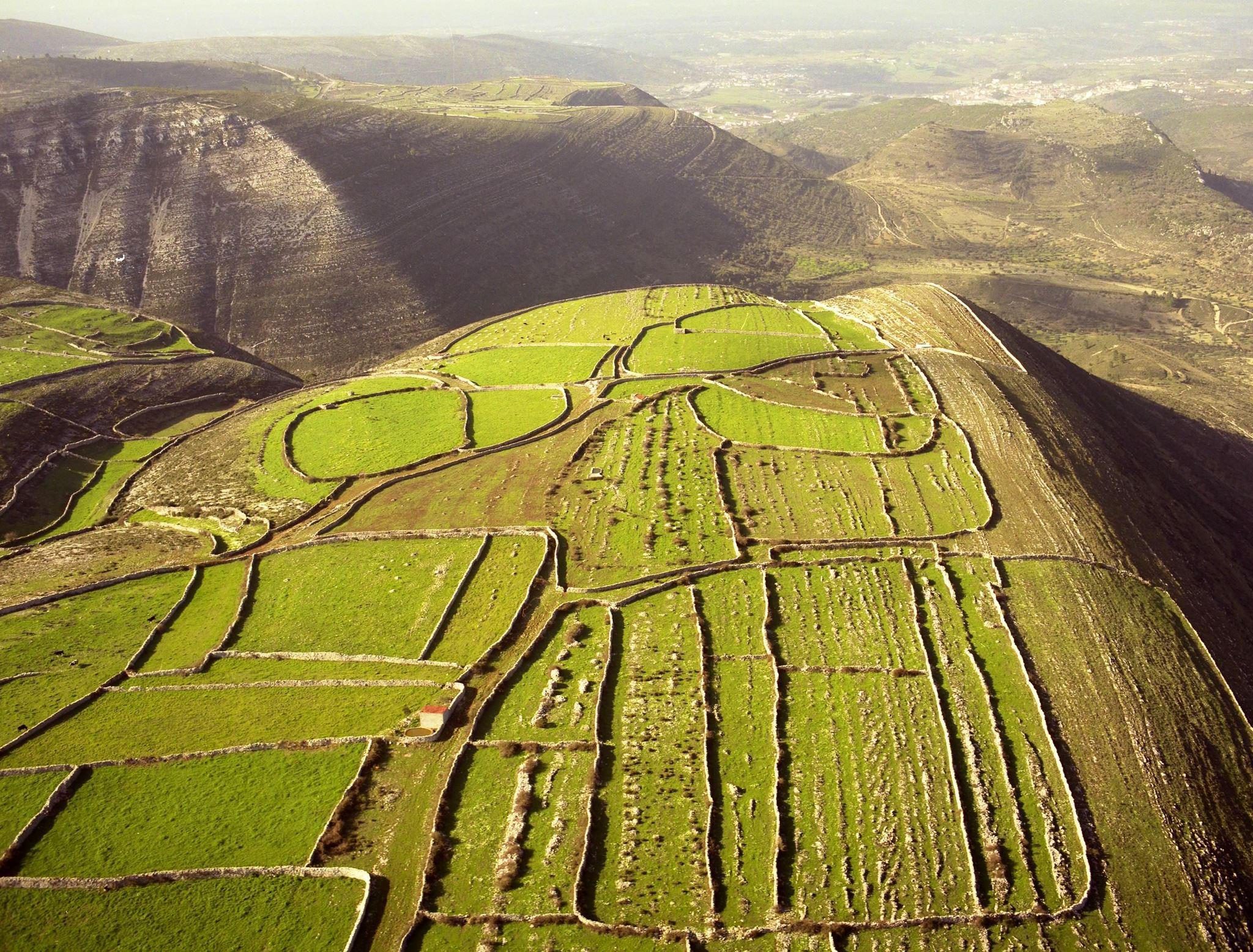
The Candeeiros Route is a long-distance walk, around 63 km in total, through the landscape of the Serras de Aire e Candeeiros Natural Park The route starts in the town of Rio Maior, after which the greatest challenge is the ascent of the Candeeiros massif, before continuing to the Sanctuary of Fátima, through the municipalities of Porto de Mós, Batalha and Ourém. The route follows ancient rural paths that link traditional villages set on the slopes, plateaus and valleys of the geocultural area known as the Estremadura Limestone Massif.
The environment lends itself to discovery, but also to rest and inner contemplation. The nature is striking and beautiful, with characteristic rocky formations and rare species of a variety of fauna and flora. The highest peaks offer views over the surrounding landscape stretching from the interior to the sea, while the valleys and plateaus provide a pleasantly peaceful setting.
Nature and life, rurality and urbanity exist side by side in harmony. Olive trees, common oaks and holm oaks stand proud amid the low-growing and spontaneous vegetation, where kermes oak and rosemary can be found. Small flocks of livestock punctuate the landscape, and dry stone walls mark out smallholdings, shepherds’ shelters and threshing floors. The area’s cultural heritage is preserved by welcoming communities that keep alive a wealth of traditions, imbued with the colours and flavours of a varied gastronomy.
Read more.


Carmelite Route
From Coimbra to Fátima
- 111 km
- 6 days
The Carmelite Route connects Coimbra to Fátima along a 111 km long trail at the heart of a peaceful and dazzling natural landscape.
This thematic itinerary is inspired by the life and work of Sister Lucy, one of the three visionary children of Fatima, who in 1947 entered the Carmel of St. Teresa in Coimbra and lived here until her death in 2005. The journey begins in Carmel Santa Teresa, near the memorial of Sister Lucy. For pilgrims, but also for walking aficionados.
Departing from Carmelo de Santa Teresa in Coimbra, the Carmelita Route is an invitation to reach the Sanctuary of Fátima through 111 km designed in the municipalities of Coimbra, Condeixa-a-Nova, Penela, Ansião, Alvaiázere and Ourém; it is an alternative route to the major road axes that offers the walker / cyclist more secure and comfortable sections.
The Carmelite Route is divided in 6 stages:
Stage 1 - Coimbra - Condeixa-a-Nova - 16 km (medium difficulty)
Stage 2 - Condeixa-a-Nova - Rabaçal - 13 km (easy)
Stage 3 - Rabaçal - Ansião - 19,5 km (difficult)
Stage 4 - Ansião - Bofinho - 13,5 km (medium difficulty)
Stage 5 - Bofinho - Seiça - 26 km (difficult)
Stage 6 - Seiça - Fátima - 23 km (difficult)