Covering an area of 2216 square km within 9 municipalities - Belmonte, Celorico da Beira, Covilhã, Fornos de Algodres, Gouveia, Guarda, Manteigas, Oliveira do Hospital and Seia - Estrela UNESCO Global Geopark offers a diversified landscape, which is the result of multiple geological transformations, high climate contrasts and an ancient human occupation dating back to the beginning of the 4th millennium bC .
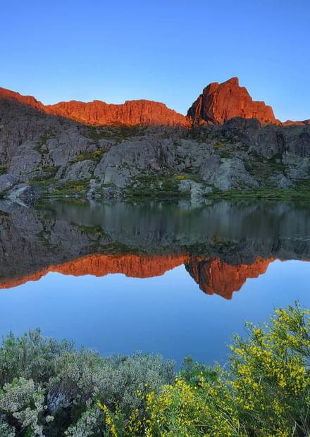
During the Pleistocene, an ice field developed on top of the plateau, creating the features that endowed the area with its distinctive geological characteristics: glacial deposits such as the Lagoa Seca moraine field, and glacial landforms, such as the Zêzere glacial valley.


The Geopark also presents a significant diversity of granite weathering forms such as the Covão do Boi granite columns, a large set of natural tor-like granite columns controlled by a dense orthogonal fracture network, together with different large forms including inselberge and smaller, mushroom-shaped formations.
In the fall 2021 the Great Route of Estrela Geopark - a 760 km long walking and cycling route - across ancient trails and shepherd routes will be opened. A whole new way of experiencing this absolutely seducing territory.
Photo credits: Filipe Patrocínio